


Every August, as Independence Day approaches, homes across India fill with flag crafts and patriotic songs and for a lot of parents, the same question: how do I make my child actually interested in India’s geography, rather than just memorising it for a school test? A map your child can touch, point at, and play with is a much easier starting point than a textbook page.
How Many States Are There in India?
India has 28 states and 8 union territories – 36 administrative divisions in total. This count has been stable since January 2020, when Dadra and Nagar Haveli merged with Daman and Diu, following the 2019 reorganisation of Jammu and Kashmir into two separate union territories (Jammu & Kashmir, and Ladakh).
The 28 states of India:
| Andhra Pradesh | Arunachal Pradesh | Assam | Bihar |
| Chhattisgarh | Goa | Gujarat | Haryana |
| Himachal Pradesh | Jharkhand | Karnataka | Kerala |
| Madhya Pradesh | Maharashtra | Manipur | Meghalaya |
| Mizoram | Nagaland | Odisha | Punjab |
| Rajasthan | Sikkim | Tamil Nadu | Telangana |
| Tripura | Uttar Pradesh | Uttarakhand | West Bengal |
The 8 union territories of India:
Delhi, Jammu and Kashmir, Ladakh, Puducherry, Chandigarh, Dadra and Nagar Haveli and Daman and Diu, Lakshadweep, and Andaman and Nicobar Islands.
Rajasthan is the largest state by area, while Uttar Pradesh is the most populous. This full list is worth teaching alongside – not instead of – the map itself: a child who can name a state on the map but has never heard the complete list rarely retains the “bigger picture” of the country.
Why Geography Sticks Better Through Play
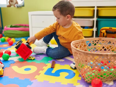
Young children don’t retain abstract facts well – a list of state names means very little to a 5-year-old on its own. What works is repetition tied to something physical and enjoyable: touching a shape, saying a name out loud, finding something on a map with their own hands. The physical act of pointing and touching helps information stick in a way that passive reading doesn’t.
For India’s geography specifically, this matters even more than usual. With 28 states and 8 union territories, each with its own language and identity, it’s a genuinely large amount of information – trying to teach it all at once, out of a textbook, is exactly the kind of experience that turns a curious child off geography altogether.
There’s also a timing advantage to teaching this around Independence Day. Flags, songs, and school programs already put the idea of “India as a country” in front of a child during this period – a map extends that same curiosity into something concrete they can touch, rather than a once-a-year classroom topic that fades by September.
Where to Start: Keep It Small
The most common mistake parents make when introducing India’s map is starting too big. Don’t aim for all 28 states in one sitting – a far more effective approach:
- Start with home. Begin with the state your family lives in, and one or two neighbouring states your child may have visited or heard of.
- Add states connected to your child’s life. A grandparent’s home state, a place from a family trip, or a state whose language or food your child already recognises are all easier entry points than a random state on the far side of the country.
- Expand slowly, in small clusters. Group geographically close states together (for example, the northeastern states, or the southern states) rather than working through an alphabetical list.
- Revisit often, briefly. Five minutes of pointing-and-naming every day beats one long 45-minute geography lesson on a weekend.
5 Fun Ways to Learn India’s States at Home
- Point & Name. The simplest starting activity – point to a state together and say its name out loud, a small group at a time.
- Capital Matching. Once a handful of states feel familiar, turn it into a light matching game: state to capital.
- Neighbour Hunt. Ask your child to find every state that shares a border with your home state – and since the map also labels neighbouring countries like Pakistan, China, Nepal, Bhutan, and Myanmar, older kids can extend this to “which countries border India?” too.
- State Facts Time. Pick one state a day and share a single interesting fact – a famous food, festival, animal, or landmark from that state.
- Independence Day Quiz. On August 15th itself, turn the week’s learning into a light, five-question family quiz, with a small prize for correct answers.
What’s Actually on the Map
Kids Land’s India Map is a full political map, with every larger state – Rajasthan, Maharashtra, Uttar Pradesh, Tamil Nadu, and the rest – shown in its own colour and labelled by name. Ten smaller states, like Goa, Sikkim, Manipur, Nagaland, and Himachal Pradesh, are too small to label directly, so they’re marked with numbered flags matching a legend printed alongside the map.
It also goes beyond India’s own borders: neighbouring countries – Pakistan, China, Nepal, Bhutan, Bangladesh, Myanmar, Afghanistan, and Sri Lanka – are labelled around the edges, along with the Arabian Sea, Bay of Bengal, and Indian Ocean, plus a compass rose. That makes it useful for more than just “name the state” – a child can start understanding India’s place in the wider region too.
Why a Foam Map Works Better Than a Printed One
A printed map on paper is fine for reference, but it doesn’t invite a young child to sit with it the way a textured, tactile version does. Kids Land’s India Map is built specifically around this idea:
- Made from EVA (Ethylene Vinyl Acetate) foam, MultiColor, Density 75 (+/-10), Hardness Shore A 25–28
- BIS Certified for material safety
- Designed for children 4 years and above
- Part of Kids Land’s Educational product range, alongside the brand’s alphabet charts and puzzle mats
Because it’s foam rather than paper, it holds up to daily handling, doesn’t tear, and can stay out as a permanent fixture in a play area – useful for a topic like geography that benefits from repeated, casual exposure rather than one formal lesson. A paper map folded away after one lesson rarely gets revisited; a foam mat left out on the floor gets pointed at and asked about far more often, simply because it’s still there. It’s also a natural fit for a classroom setting, where a group of children can sit around one mat together.
You can find the India Map on the Kids Land website, alongside the rest of Kids Land’s educational foam toys.
Frequently Asked Questions
At what age should a child start learning India’s states?
Most children can begin recognising a handful of states and their own home state from around age 4–5, which is why Kids Land’s India Map is designed for children 4 years and above.
How many states are there in India?
India has 28 states and 8 union territories, totalling 36 administrative divisions. This has been the count since January 2020.
How many states should I teach at once?
Start with 2–3 states your child already has a connection to – home state, a relative’s state, or a place they’ve visited – rather than all 28 at once.
What do the numbered flags on the map mean?
Ten smaller states – including Goa, Sikkim, Manipur, Nagaland, and Himachal Pradesh – are too small to label directly, so they’re marked with numbered flags matching a legend beside the map.
Does the map show anything outside India?
Yes – neighbouring countries (Pakistan, China, Nepal, Bhutan, Bangladesh, Myanmar, Afghanistan, and Sri Lanka) are labelled around the border, along with the Arabian Sea, Bay of Bengal, and Indian Ocean.
What’s a good Independence Day activity using the map?
A simple quiz works well: pick five states covered that week, ask one question about each (a nearby state, a neighbouring country, or a fun fact), and celebrate correct answers with a small reward.
Is a foam map safe for young children to handle daily?
Kids Land’s India Map is made from BIS-certified EVA foam, a soft, non-toxic material designed to withstand regular handling by children 4 years and above.
Where can I buy an India Map learning toy for my child?
Kids Land makes a BIS-certified EVA foam India Map, available on the Kids Land website.
Related posts

Popular Posts
-
Learn ABCD and Numbers 1 to 10: A Fun Guide for Kids
September 13, 2026 -
 The Benefits of Educational Foam Toys for Child Development
June 6, 2023 -
 Safe, Soft, and Super Fun: Kids Land’s Foam Toys for Hours of Playtime Joy!
July 5, 2023 -
Inspiring Young Minds with Educational Foam Toys from KidsLand
June 5, 2024 -
How Interactive Toys Enhance Learning in Early Childhood
July 1, 2024
Recent Comments